

Capturing Key Drone Footage in Design and Construction
The Aerial Site Plan Photo
Aerial site plan photos are invaluable for in-depth project studies. They provide a holistic view of the entire site, allowing professionals to analyze spatial relationships, identify potential challenges, and make informed decisions. These images are also useful for Project Study, Site Context, Feasibility, Presentations, and monitoring Construction Progress.
How to: If unable to fly high enough to take a full-site photo, you should take multiple plan view shots from different locations and stitch them together with Adobe Photoshop Merge Photograph Tool. This will quickly create a large, high-resolution aerial for use.
Elevation Truckings
Elevation trucking shots offer a dynamic way to reveal project designs, create smooth video transitions, and enhance B-reel footage. These shots provide a unique perspective on the building's facade, adding a cinematic touch to visual storytelling.
Horizontal Trucking
Choose a building elevation and height. Allow the video subject to gradually fill the frame as the drone passes parallel along the building facade, creating a visually appealing and revealing effect.
Vertical Trucking
Start from the base of the building or subject and elevate the drone with no directional movement except upward. This method showcases the project's height and facade with a visually appealing effect.
Project Drawback or “Dronie”
The "Dronie" maneuver is an effective way to reveal the project site and context in a simple yet engaging manner.
Utilize the DJI Quick Shots Dronie Function for a quick and straightforward execution, capturing a captivating aerial shot that introduces the project site and its surroundings.
Aerial 360 Orbit
Performing a complete 180 or 360 orbits of the project at various heights allows for capturing diverse angles of the project, offering a comprehensive view for documentation or promotional purposes.
Use DJI Quick Shots "Circle" or "Helix" intelligent flight modes to effortlessly execute aerial 360 orbits, creating visually stunning footage with minimal effort.
The Invaluable 360 Degree Photo
A 360-degree drone photo provides a complete and panoramic view of the construction or design project, offering a comprehensive overview of the entire site. This visual data is invaluable for architects, designers, and construction teams to assess the spatial layout and understand the project in its entirety.
Conclusion
Mastering the art of aerial photography opens up a world of possibilities in the construction and design industry. From detailed site plans to cinematic elevation truckings, each technique serves a specific purpose, contributing to a richer visual narrative of the project.
To stay up-to-date and gain valuable tips and tricks, subscribe to our newsletter below!
Aerial Photomerge with Photoshop
Photomerged Images for Aerial
Example of Elevation Trucking
Example of a Site “Dronie”
Example of an Aerial 360 Degree Orbit
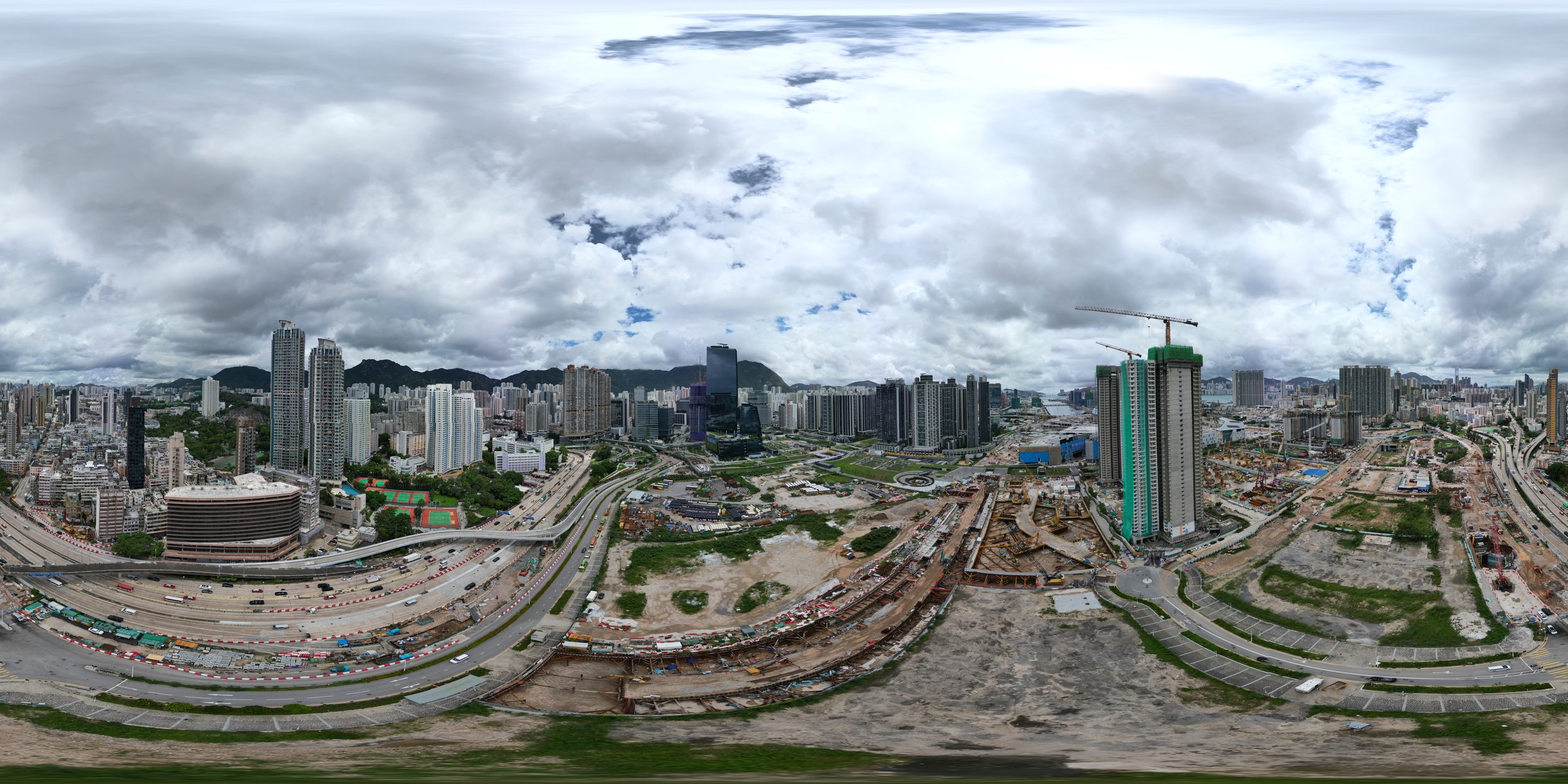
Example of an Aerial 360 Degree Photo