

Design to Facility Management, the Laser Scanning Journey
The design and construction industry today has numerous technology solutions. Typically, value and price dictate what technology is deployed on a project. As strategic advisers in the implementation and utilization of design and construction technology for small and large projects globally, we have prepared our insights about laser scanning. To learn more about how we use Laser Scanning and see more examples, please visit our channel at https://bit.ly/3Klnk6M.
What is Laser Scanning?
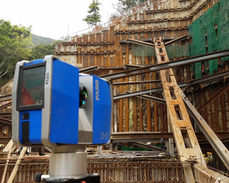
Laser scanning is the controlled steering of laser beams followed by a distance measurement at every pointing direction. It will rapidly capture shapes of objects, buildings, and landscapes. Often, the capture of imagery will be associated and overlaid onto the collection of points and distances to create an accurate representation of the conditions being scanned.
What does laser scanning solve?
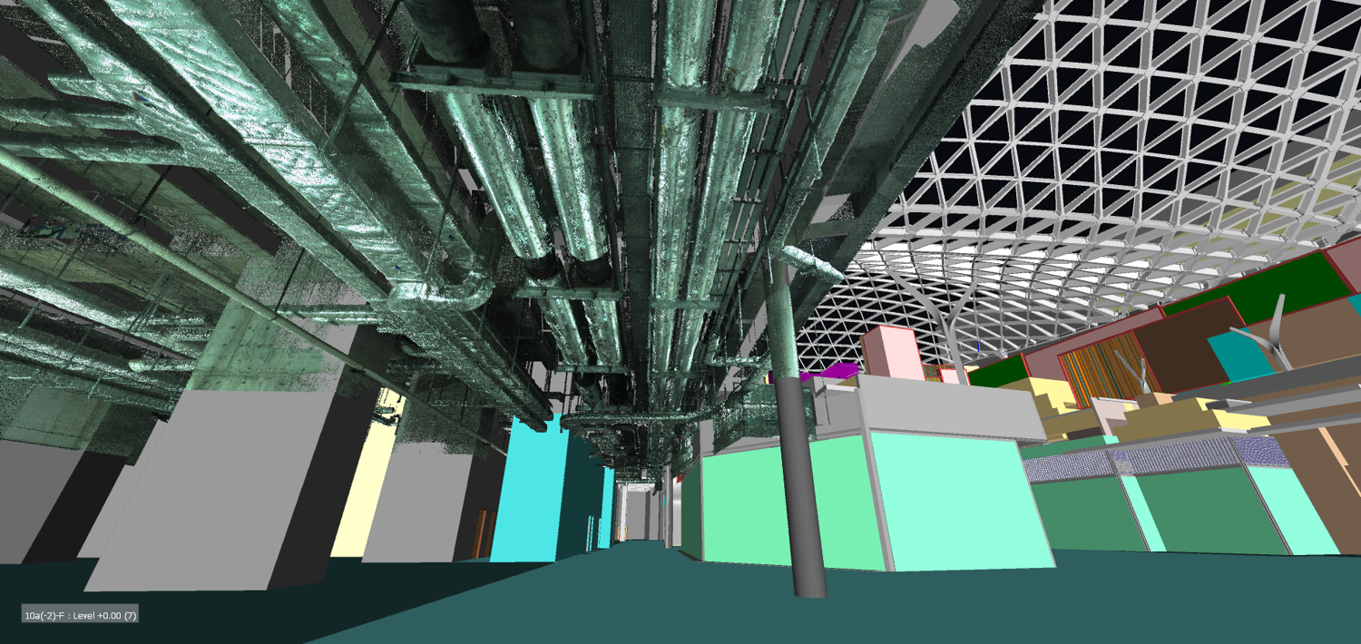
Laser Scanning collects vast amounts of usable data, especially in hard-to-access areas.
It reduces uncertainty and risk for the project and site.
Scanning dramatically increases the safety of surveying crews and raises project awareness to on and off-site managers and staff.
It significantly decreases on-site resources as post-processing and analyzing moves to the back-office.
All the above while improving the quantity and quality of the data collected.
Often we are asked, “What benefits does Laser Scanning have for me?”
Scanning helps everyone!
Engineering Consultants
Contractors, Sub-Contractors and Tradesman
Owner, Asset, and Facility Management Teams
Designers and Engineers gain a tremendous amount of accessible data and viewpoints to further analyze and inform their designs to develop a project. Comprehension of existing and upcoming sites, conditions and projects is fundamental for any design and engineering exercise. Laser scanning reduces the ambiguity of the project to develop creative designs and reduce oversight providing a comprehensive solution and a more informed team.
Contractors and Tradesman use the Laser Scans to monitor site activity. Scanning replaces traditional survey methods which are time consuming, don’t collect nearly enough points or information and is more safe and mobile. This information can then be moved off-site for further analysis bringing the project site to the back office staff and the remote design, engineering and management teams.
Owners, Asset and Facility Management Personnel will receive an enormous amount of accurate, accessible and navigable data useful in the maintenance of their facility, planning of future works and presentations – even using it for teaching and learning exercises across their entire organization! It allows them to quickly and easily field verify often complex and time consuming areas of their facility which 2D drawings, specifications and BIM couldn't. Now, it is increasingly being used to validate the completion of works by the contractor.
Laser scanning is not perfect.

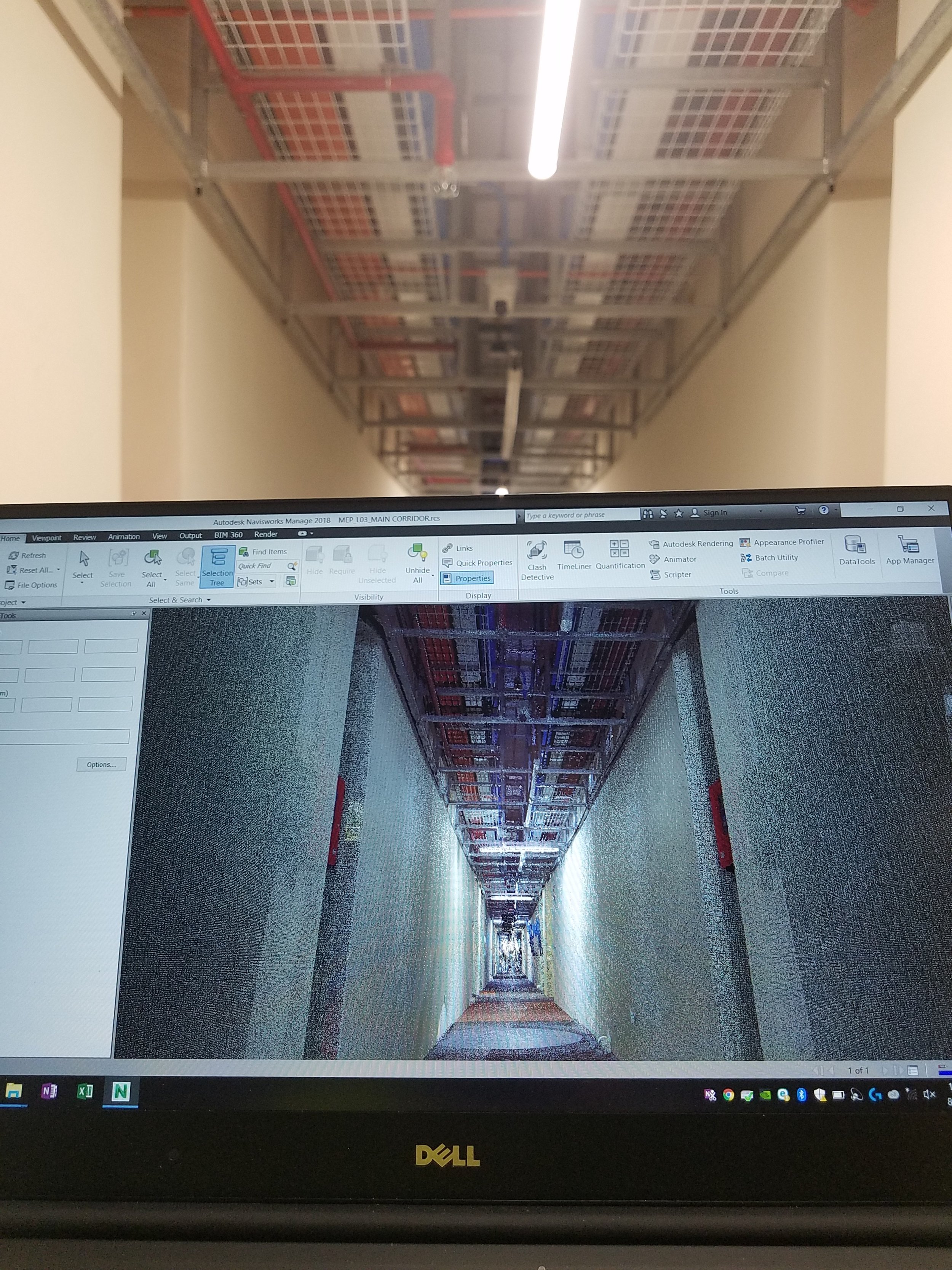
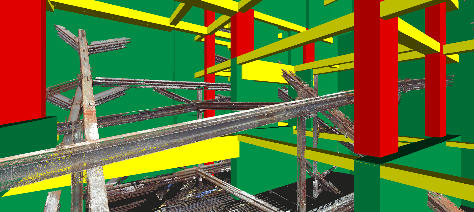
Laser Scanning produces highly accurate point clouds which can be very large depending on the size of the area, amount of scans, point cloud resolution and if it is overlaid with images or color tint. This can stress the IT department of organizations as more senior personnel require better computing technology. Combine this issue with the advance of cloud computing and remote data access, accessing scan data remotely or on-demand in the field will be challenging. Once a scan is complete, it is a point in time and if new conditions are to be incorporated they will need to be scanned again and incorporated into the previous scan data.
At what scale should a Laser Scan be used?
Laser Scanning can be used at any scale, from small-scale industrial engineering to preservation of historic and iconic relics to buildings and massive infrastructure projects. Most importantly we recommend and advise on the justification to perform the scan. Many uses include:

Mapping of existing sites or buildings.
Scanning of temporary works.
Preservation of historic buildings for remodels.
Providing access to information for people who cannot visit.
Hard to reach or inaccessible areas.
Collecting newly constructed information for as-built records.
Validating Work Completed and As-Built BIM Models.

During which project phases should a Laser Scan be used?
Laser Scanning can occur at any project stage. Most notably is the workflow change we typically see when using BIM to deliver a project. We find it better to scan the project during and at completion to begin the reconciliation of the model to deliver as an as-built model / drawings / laser scan for future Asset and Facility Management use.
